Itinerary
| Day | Camp | Miles | Climb / descent |
|---|---|---|---|
| Thu Oct 15 | Convict Lake Campground Drive up from the Bay, ~6.5 hr. Acclimation night. 7,588 ft. |
— | — |
| Fri Oct 16 | Lake Genevieve Creek crossing and the scree section. 9,955 ft. |
7.0 | +2,950 / −500 ft |
| Sat Oct 17 | Laurel Lakes Short but up and over the ~10,800 ft divide. 9,760 ft. |
4.6 | +1,250 / −1,500 ft |
| Sun Oct 18 | Lake Dorothy Back over the divide. Highest and coldest camp. 10,275 ft. |
6.5 | +1,950 / −1,450 ft |
| Mon Oct 19 | Out — Convict Lake trailhead Full scree descent. Start early. Home that evening. |
6.4 | +50 / −2,750 ft |
Weather
| Night | Camp | High | Low | Wind | Source |
|---|---|---|---|---|---|
| Thu Oct 15 | Convict Lake CG | 64° | 33° | 10–15 mph | NWS |
| Fri Oct 16 | Lake Genevieve | 51° | 29° | 5 mph | NWS |
| Sat Oct 17 | Laurel Lakes | 51° | 28° | 5–15 mph | NWS |
| Sun Oct 18 | Lake Dorothy | 50° | 27° | 10–25 mph | NWS |
| Mon Oct 19 | Hike out | — | — | — | past forecast range |
Sunny and clear every day. NOAA / NWS Reno point forecasts, issued Oct 12, 2026. Links open the current forecast.
Route map
Trail geometry from the OpenStreetMap path network, routed leg by leg; tap a line for its mileage and a marker for camp details. Switch base layers top-right. The red marker is the Convict Creek crossing where OSM maps a bridge that 2022 trip reports say is gone.
Permit & reservations
- Wilderness permit — BOOKED. Inyo NF #233262, division
Convict Creek (JM04), entry Fri Oct 16.
Camps declared: Fri Lake Genevieve, Sat Edith Lake, Sun Lake Dorothy. Saturday is actually at Laurel Lakes, which sits outside the wilderness and so is not a permit option — Edith is the nearest listed lake, declared to keep the itinerary complete.
Reserve on Recreation.gov → - Campground — BOOKED. Convict Lake Campground,
Thu Oct 15, 7,588 ft. Arrive, sleep, acclimate; walking Friday morning.
Convict Lake Campground → - Note: campground checkout is midday, so the van moves to the trailhead lot before you start walking — it cannot stay in the site.
Trailhead & drive
- Trailhead: Convict Lake, 37.59511, −118.85262
- Parking: day-use / trailhead lot — the van can't stay in the campground site past checkout.
- Route: ~6.5 hr via Tioga Pass. Tioga is normally open in mid-October but closes on the first real storm; the reroute is Sonora Pass, add ~2 hr.
- Daylight: sunrise 07:05, sunset 18:18 — 11.2 hr.
Getting there
Valhalla driving route, 268.0 mi / 5.9 hr. The amber marker is the CA-120 junction where you must take New Priest Grade. Mileage differs slightly from the table below because that was routed with OSRM — different router, slightly different line.
Route options
| Route | Miles | Est. hr | Seasonal risk |
|---|---|---|---|
| OUT · Thu Oct 15 — Tioga Pass (CA-120) Morgan Hill → US-101 → I-680 → CA-84 → I-580 → I-205 → I-5 → CA-120 (Manteca/Escalon) → New Priest Grade → Big Oak Flat Rd → Tioga Rd → Tioga Pass 9,943 ft → US-395 S → Convict Lake Rd |
275.1 | 6.60 | Tioga Rd is the seasonal link. Average season-ending close Nov 3 (1933–2022 record); earliest ever Sep 4, latest Jan 17. Across 2008–2022 the earliest season-ending closure was Oct 21 2021 — Tioga was open on Oct 19 every year of that 15-year window. Normally open mid-October, not guaranteed. Short storm closures that later reopen are separate and common. Last cycle: closed Nov 12 2025, reopened May 15 2026. Mono Basin Research — Tioga Pass opening/closing record → |
| RETURN · Mon Oct 19 — Tioga Pass Convict Lake Rd → US-395 N → Tioga Rd → Big Oak Flat Rd → New Priest Grade → CA-120 → CA-99 → I-5 → I-205 → I-580 → CA-84 → I-680 → US-101 |
274.6 | 6.58 | Same Tioga dependency, but on the way out of the range. A storm closing Tioga behind you Oct 17–19 strands you east of the crest and forces the Sonora or 395-south detour. This is the direction that actually costs you. NPS — Tioga Road status → |
| Fallback 1 — Sonora Pass (CA-108) Splits from the Tioga line at the CA-108/CA-120 junction near Yosemite Junction · Sonora Pass 9,624 ft · US-395 S through Bridgeport and Lee Vining |
294.9 | 6.69 | Caltrans D10 normally closes Sonora for winter late Nov–Dec (2022: late Nov; 2025–26 season: closed Dec 26 2025). Normally open mid-October. Does not touch Priest Grade or Yosemite — no park entrance fee. Caltrans District 10 news → |
| Fallback 2 — Ebbetts (CA-4) + Monitor (CA-89) Stockton surface → CR-J7 Farmington Rd → Ebbetts Pass 8,736 ft → Monitor Pass → US-395 S |
332.3 | 7.32 | Same Caltrans D10 winter schedule as Sonora (typically late Nov–Dec), normally open mid-October. Worst road of the three for a tall van: narrow, no centerline, one-lane sections, tight switchbacks; RVs and semis not advised. No reason to pick it over Sonora except a CA-108-specific closure. Ebbetts Pass reference → |
| Fallback 3 — US-50 Echo Summit / Carson Valley CA-4 → CA-99 → US-50 Echo Summit → CA-89 Luther Pass → US-395 S via Gardnerville, Bridgeport, Lee Vining |
367.9 | 7.87 | US-50 over Echo Summit is maintained year-round — chain controls, not a seasonal gate closure. Not truly all-season in a big storm (can shut for hours to days), but it is the shortest option if Tioga, Sonora and Ebbetts are all gated. A CA-88 Carson Pass variant also exists at 379.5 mi / 8.56 hr. Caltrans QuickMap road conditions → |
| Worst case — south via Mojave, US-395 north US-101 → CA-152 Pacheco Pass → I-5 → CA-58 Tehachapi → CA-14 Mojave → US-395 N through Ridgecrest, Lone Pine, Bishop |
489.5 | 9.61 | The genuinely all-season answer — no Sierra crossing at all, around the south end of the range. Roughly +214 mi and +3.0 hr each way over Tioga. This is the number to plan the exit around if a storm shuts every pass while you are on the east side. OSRM routing → |
OSRM times are free-flow car-profile estimates — no traffic, no grade penalty, no weight penalty, no stops. For a loaded tall diesel Sprinter budget roughly 7.5–8.5 hr door to camp on the Tioga route. Leave Morgan Hill early enough to clear I-680/I-580 Altamont before commute traffic and to reach Lee Vining before the Mobil closes at 21:00.
Diesel
| Stop | From camp | Notes |
|---|---|---|
| Crowley Lake General Store (Shell) 474 S Landing Rd · 37.56725, −118.74188 · (760) 935-4666 |
10.0 mi ~17 min |
The one to rely on. Diesel, 24/7 per Shell's own station listing. Closest diesel to camp and the only nearby pump that does not close at night. Directly on US-395. |
| Tioga Gas Mart (Mobil), Lee Vining 22 Vista Point Rd · 37.94724, −119.11315 · US-395 at CA-120 |
32.4 mi ~42 min |
Last diesel coming over Tioga Pass — nothing between here and June Lake Junction. Synergy Diesel Efficient confirmed on the ExxonMobil station finder. Listed 06:30–21:00 daily, not 24 hr: a late Thursday arrival over Tioga can find it shut. |
| Chevron, Mammoth Lakes 3236 Main St · 37.6481, −118.96977 · via CA-203 |
10.2 mi ~18 min |
Diesel confirmed. Town backup with real services. 24 hr status unverified. Shell at 3011 N Main also has diesel, listed 05:30–00:00. |
| Shell, Bridgeport 38.25537, −119.23161 · where CA-108 lands on US-395 |
58.1 mi ~1.24 hr |
Last diesel coming over Sonora Pass. Tagged fuel:diesel=yes in OpenStreetMap; hours unverified — treat as daytime-only. |
| Chevron, Bishop N Main St / US-395 · 37.37556, −118.4182 |
35.3 mi ~46 min |
Largest fuel and services town on the 395 corridor; multiple diesel pumps (Chevron, Shell, Speedway, Vons). 24 hr status unverified. Fill here on the southern all-season route. |
Two things about the drive
maxweight=7500 lb / hgv=no; the Sprinter's GVWR is over that.
Take New Priest Grade instead — waypoint 37.82432, −120.28297. Costs +2.8 mi.Satellite
Two dated aerial sources cover this route, plus undated USGS cartography. NAIP — 0.6 m ground sample distance, captured 2022-07-10 across every quad in this area (date decoded from the catalog item names returned by the USGS ImageServer; a single flight date, no mosaicking). Esri World Imagery — here it is not the usual undated case: the service's own metadata returns SRC_DATE 20241119, 0.5 m, WorldView-2, provider Vantor "Vivid", stated positional accuracy ±8.47 m, and identify at every sampled point in every frame returned that same scene. USGSTopo frames have no capture date at all — they are compiled cartography over shaded relief, not photography. The newest pixel anywhere below is 2024-11-19, about 22 months before the trip. Only the Sentinel-2 creek-flow frames are from 2026. All crosshairs and labels are drawn from OSM/recon coordinates, not detected in the imagery.
Creek flow — October
| Value | Source | |
|---|---|---|
| 2026 snowpack, Apr 1 | 12.6 in — 38% of the 2005–2025 average (33.5 in) | CDEC Mammoth Pass |
| Snowpack now | 0 in | CDEC Mammoth Pass |
| Convict Creek, mid-July median | 61 cfs | USGS 10265200, 1960–75 |
| Convict Creek, mid-October median | 12 cfs | USGS 10265200, 1960–75 |
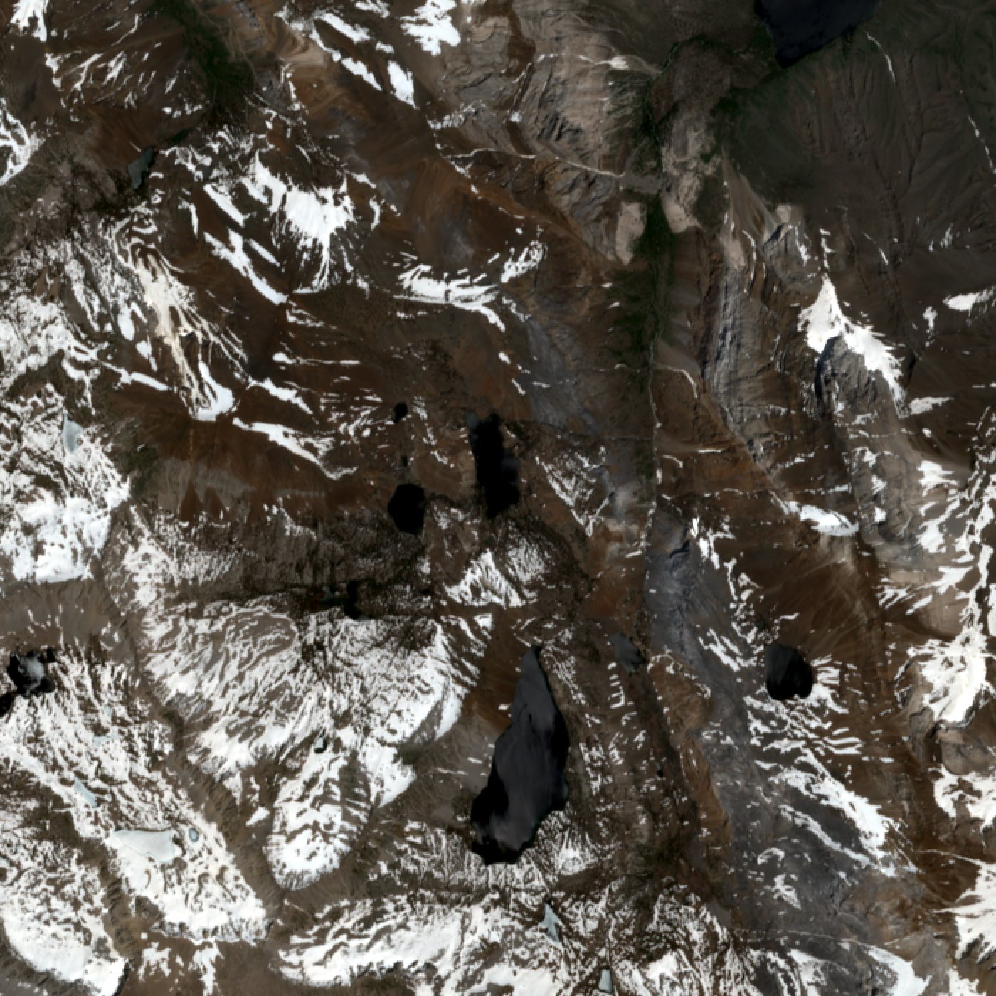 Jun 4, 2026
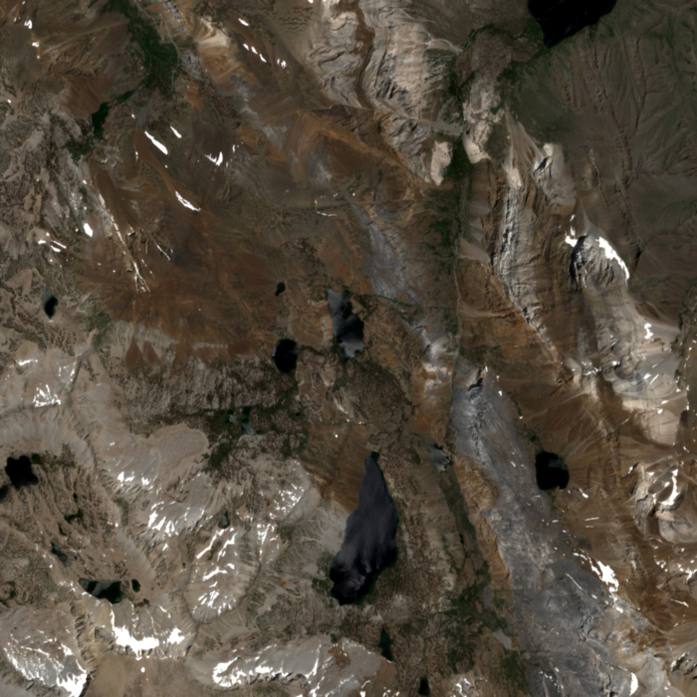 Jul 9, 2026
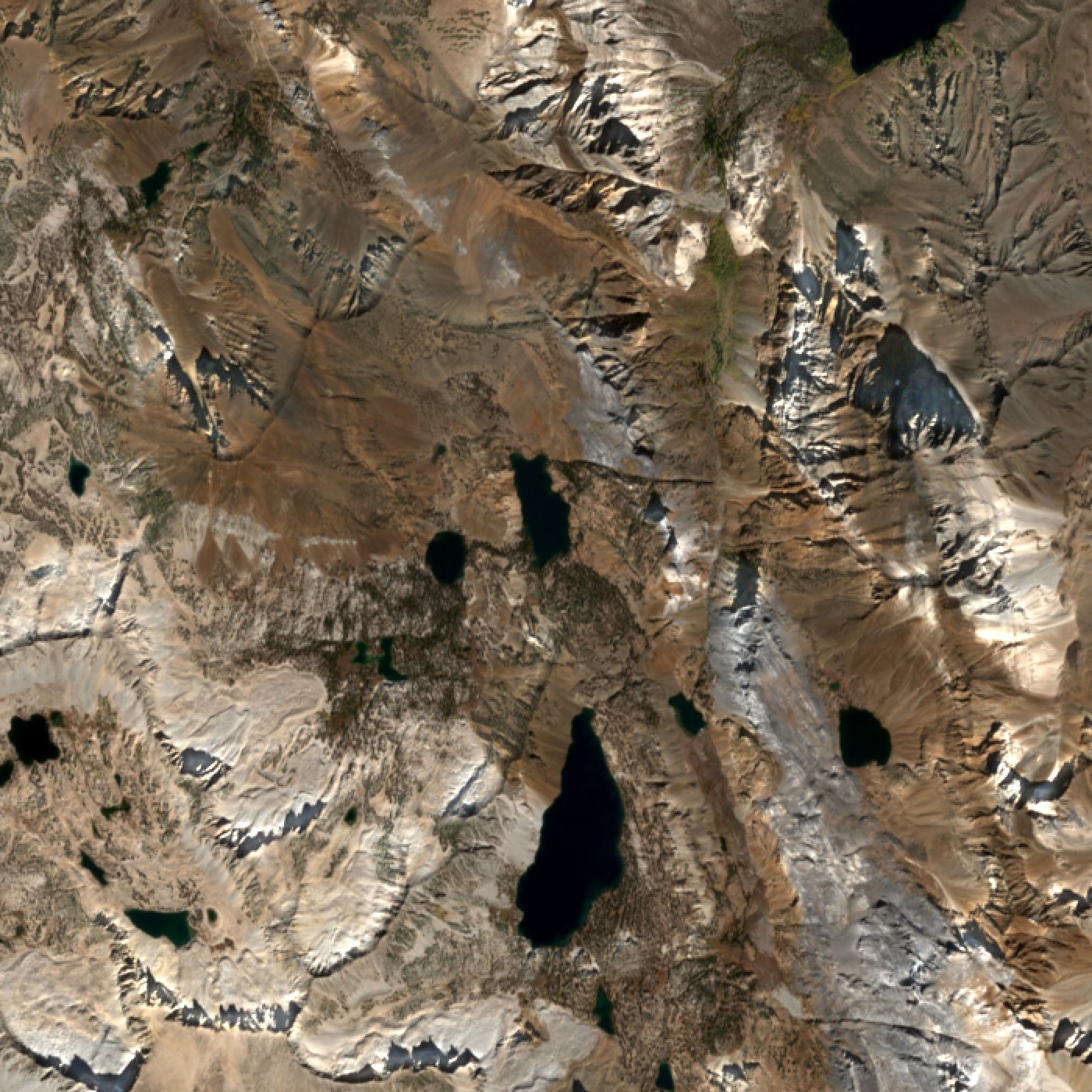 Oct 7, 2026 — no snow left in the basin
Sentinel-2 L2A, 10 m, 7 km frame centered on the upper Convict basin (Genevieve, Dorothy, Mildred). Copernicus data via Earth Search.
Convict Creek crossings — the bridge question
What is legible: Convict Creek reads clearly in the July 2022 NAIP frames as a continuous bright whitewater ribbon at both crossings — it was running hard and turbulent in mid-July, which is real information about the character of the ford even though depth is not. And the scree is unmistakable: the entire east bank between Mildred Lake and the mile-3.62 crossing is one continuous pale talus apron. Terrain-scale features like that are far above the resolution limit and are the most trustworthy thing in this set.
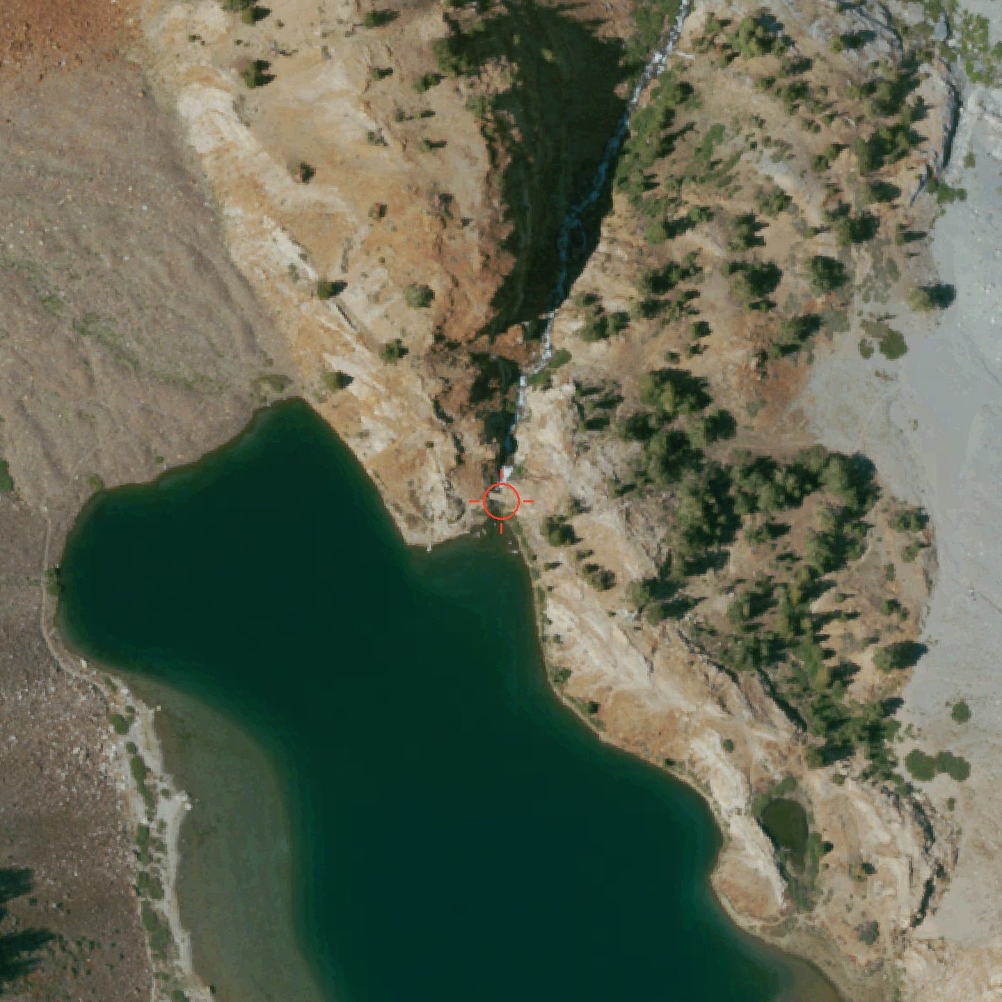 Mapped bridge node, mile 4.87 (37.547408, −118.874219 — red crosshair). NAIP, captured 2022-07-10, 0.6 m native, 340 m frame rendered at ~0.24 m/px — resampled past native, so no additional detail exists at this zoom. Snow-free midday, and contemporaneous with the 2022 trip reports. A 6 m span is 2–3 pixels here: this frame cannot show a bridge present or absent.
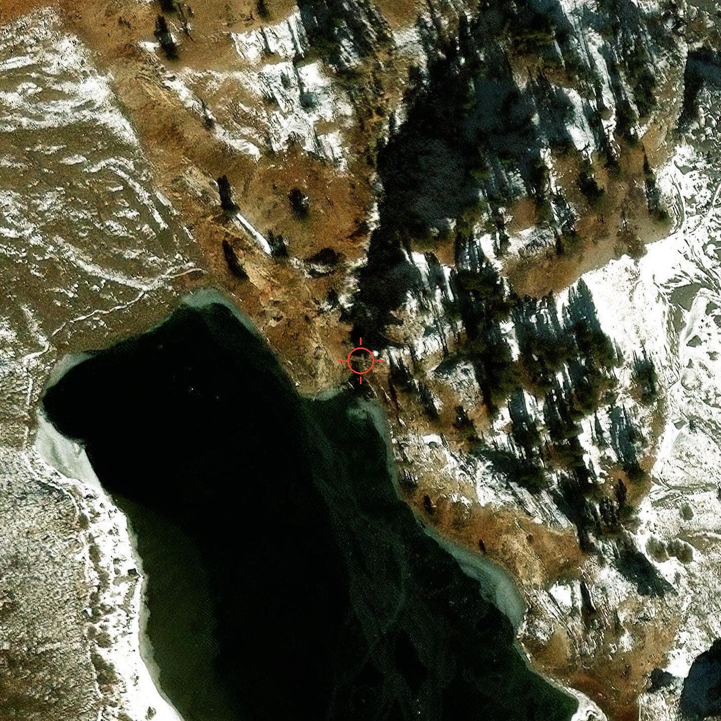 Same node. Esri World Imagery / WorldView-2, captured 2024-11-19 (SRC_DATE 20241119), 0.5 m native. Newer by 28 months and still cannot resolve the span — and it is a mid-November capture, carrying early-season snow and low-sun canyon shadow that hide more ground than they reveal.
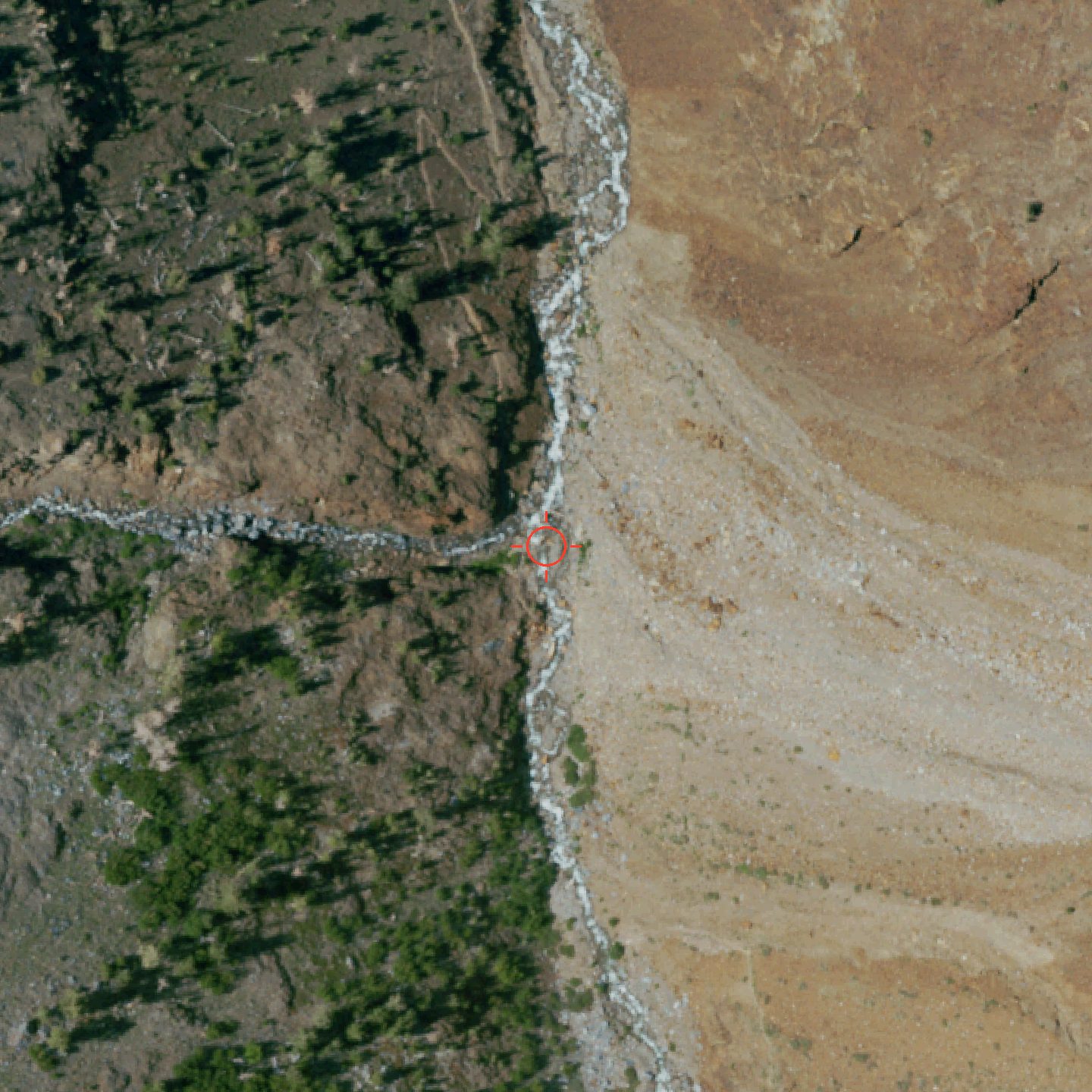 Main-stem crossing, mile 3.62 (37.559899, −118.872687 — amber crosshair; untagged in OSM). NAIP, captured 2022-07-10, 0.6 m native at ~0.24 m/px. The creek is unbroken whitewater through the frame. No structure is resolvable, and none would be at this pixel scale.
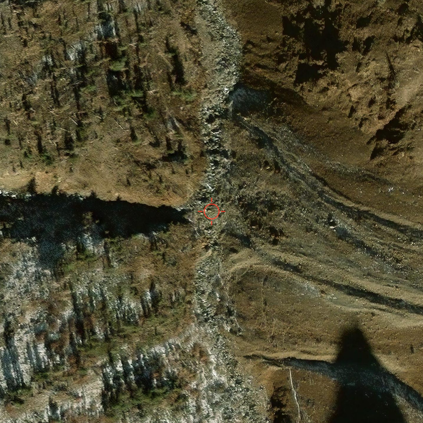 Same crossing. Esri / WorldView-2, captured 2024-11-19, 0.5 m native. The west approach sits in full canyon shadow in this frame — that ground is not readable at all here.
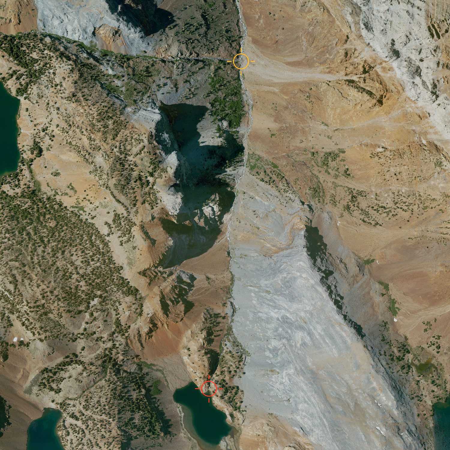 Context, 1,900 m frame — Mildred Lake to the mile-3.62 crossing. NAIP, captured 2022-07-10, 0.6 m native. The continuous pale grey talus and debris apron running the full length of the east bank is the clearest thing in this whole section — landform-scale, well above the resolution limit, and it corroborates the reviewers' scree reports. Canyon geometry is plain: steep-walled, narrow, trail forced onto the west side. The trail itself is only intermittently traceable as a faint tan line across open slopes and is invisible under canopy and in shadow.
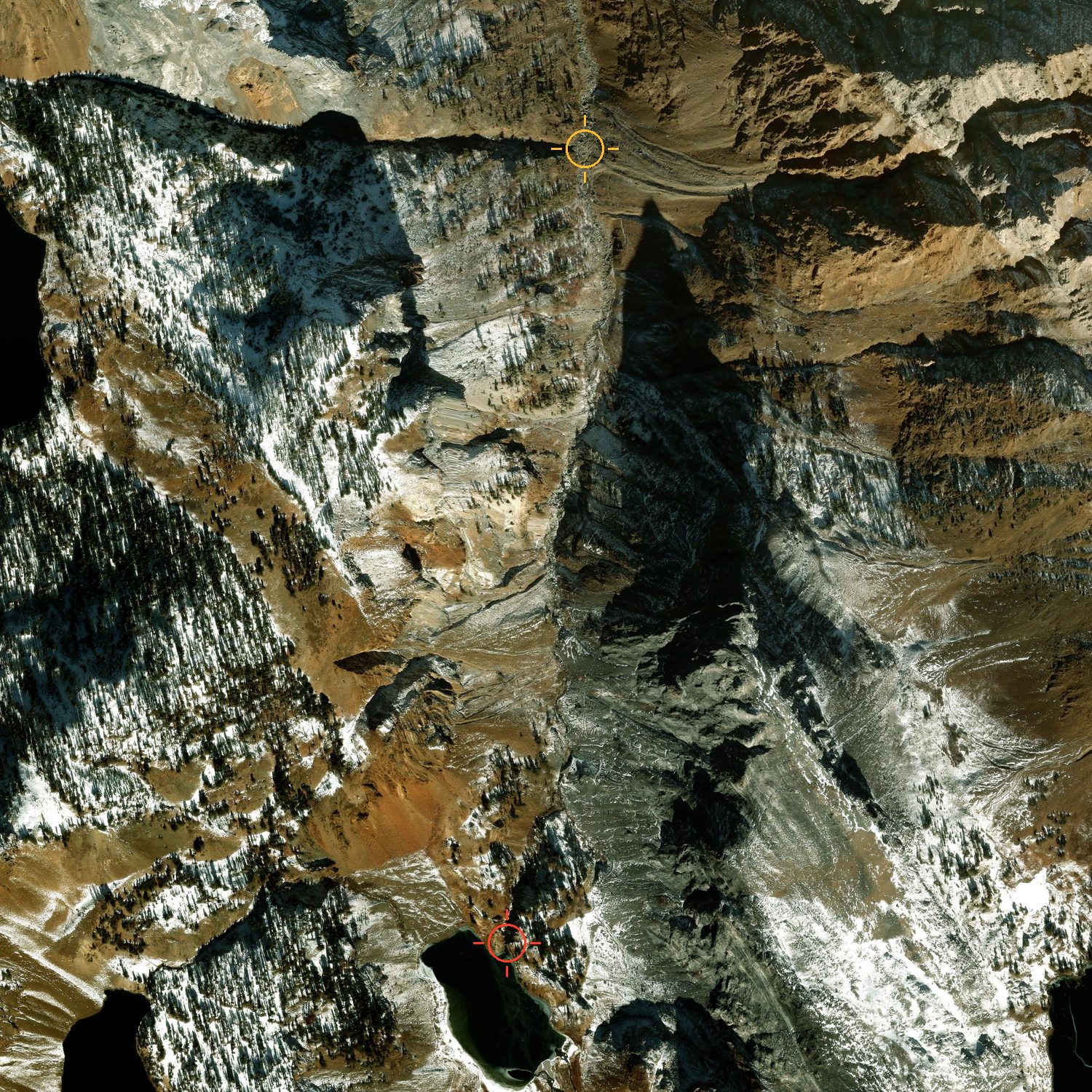 Same 1,900 m frame. Esri / WorldView-2, captured 2024-11-19, 0.5 m native. Recency and usefulness point in opposite directions here — this is the newer image and it shows materially less ground, with early-season snow on north aspects and a long low-sun shadow over the creek corridor.
Route overview
Frame 37.535,−118.9193 → 37.5991,−118.8476 — 4.96 mi N–S × 2.75 mi E–W, rendered in EPSG:3857 so the aspect is true. Delivered resolution is the binding constraint, not source resolution: to keep each file under 900 KB these are 3.99 m/px (NAIP, topo) and 4.99 m/px (Esri), so the native 0.6 m and 0.5 m sharpness is not present in these files. At 4–5 m/px you can read the drainage geometry of the whole Convict Creek trench, the position and outlet of every itinerary lake, the large light-toned talus aprons, treeline, snow distribution and gross steepness by shadow. You cannot read trail tread — a 2–3 ft footpath is well under one pixel, so the trail is not visible anywhere in either aerial frame. Any trail line the eye picks up on the topo image is drawn cartography. The Genevieve washout is likewise sub-pixel; absence of a visible scar is not evidence the trail is intact.
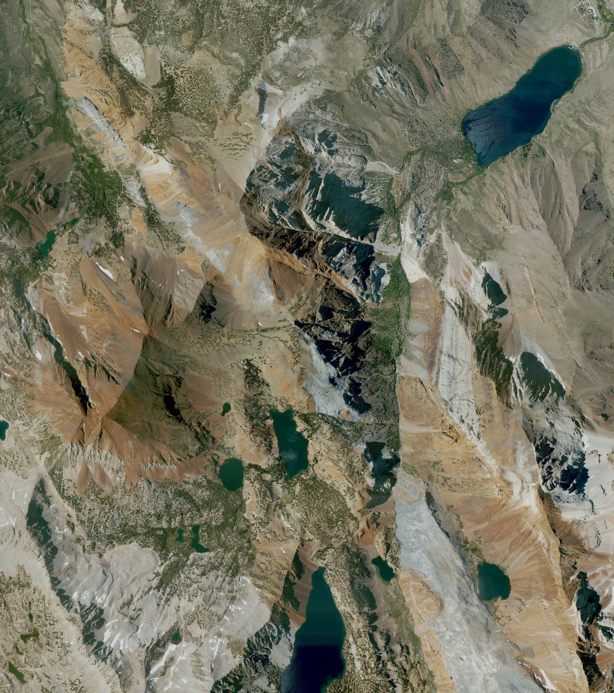 NAIP, captured 2022-07-10 (four Category-1 quarter-quads, all one flight date), 0.6 m native but delivered at 2000 px ≈ 3.99 m/px. Snow-free apart from a few high residual patches and evenly lit — the better route-overview image despite being the older one.
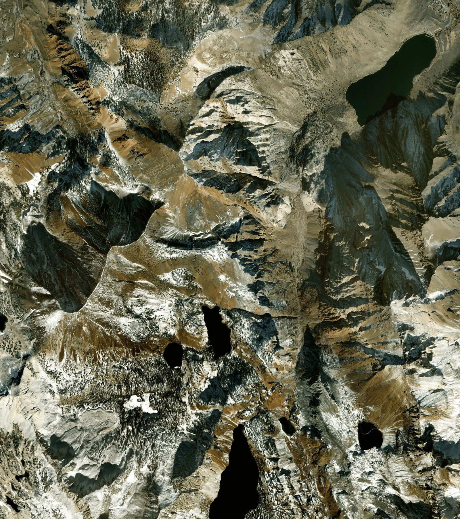 Esri World Imagery / WorldView-2, captured 2024-11-19, 0.5 m native (resampled to 0.3 m by the provider) but delivered at 1600 px ≈ 4.99 m/px. An older 2023-10-12 WV02 scene underlies this footprint, but identify at all six key points returned 20241119 only. Newest imagery available and the worse frame to read terrain: early-season snow and very long November shadows black out much of the western and southern ground. Not representative of the trip window.
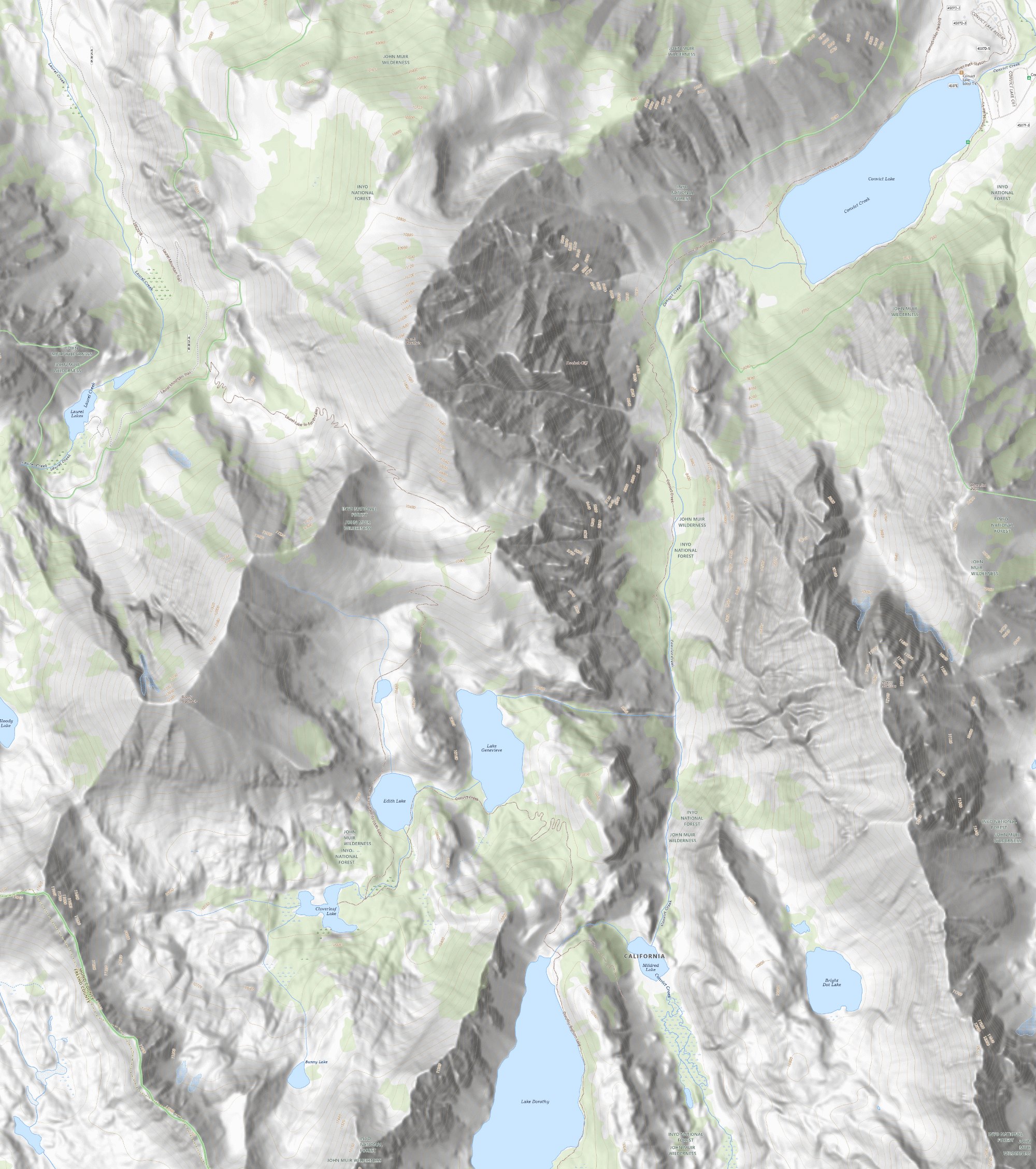 USGS "USGSTopo" seamless topo. No capture date exists — this is a cartographic tile cache, not photography. The service states only that it "combines the most current data in The National Map" and publishes no per-tile or per-quad vintage. Treat the contours, trail lines and labels as undated compiled cartography, not as an observation of current ground conditions.
Trailhead, parking & campground
At 0.5–0.6 m the paved day-use loop, the boat-launch lot, the gravel lots by the resort and the separate Convict Creek trailhead lot to the north are all clearly outlined, with individual vehicles countable in both years — useful for judging where a long tall van can actually turn and sit. The campground loop road and individual site spurs are distinct. This is also the one place in the dossier where the trail itself is genuinely legible: 28E03 shows as a thin line leaving the lake's northeast corner across open decomposed granite. It disappears wherever it enters the willow, aspen and conifer corridor. Nothing vertical is readable from nadir imagery at any resolution — overhead limbs, low branches over spurs, height and length limits, site levelness or surface, gate position, or whether the campground was open on any date. No signage or kiosks are legible. The Convict Creek crossings are 4–5 mi up-canyon and lie entirely outside all eight of these frames.
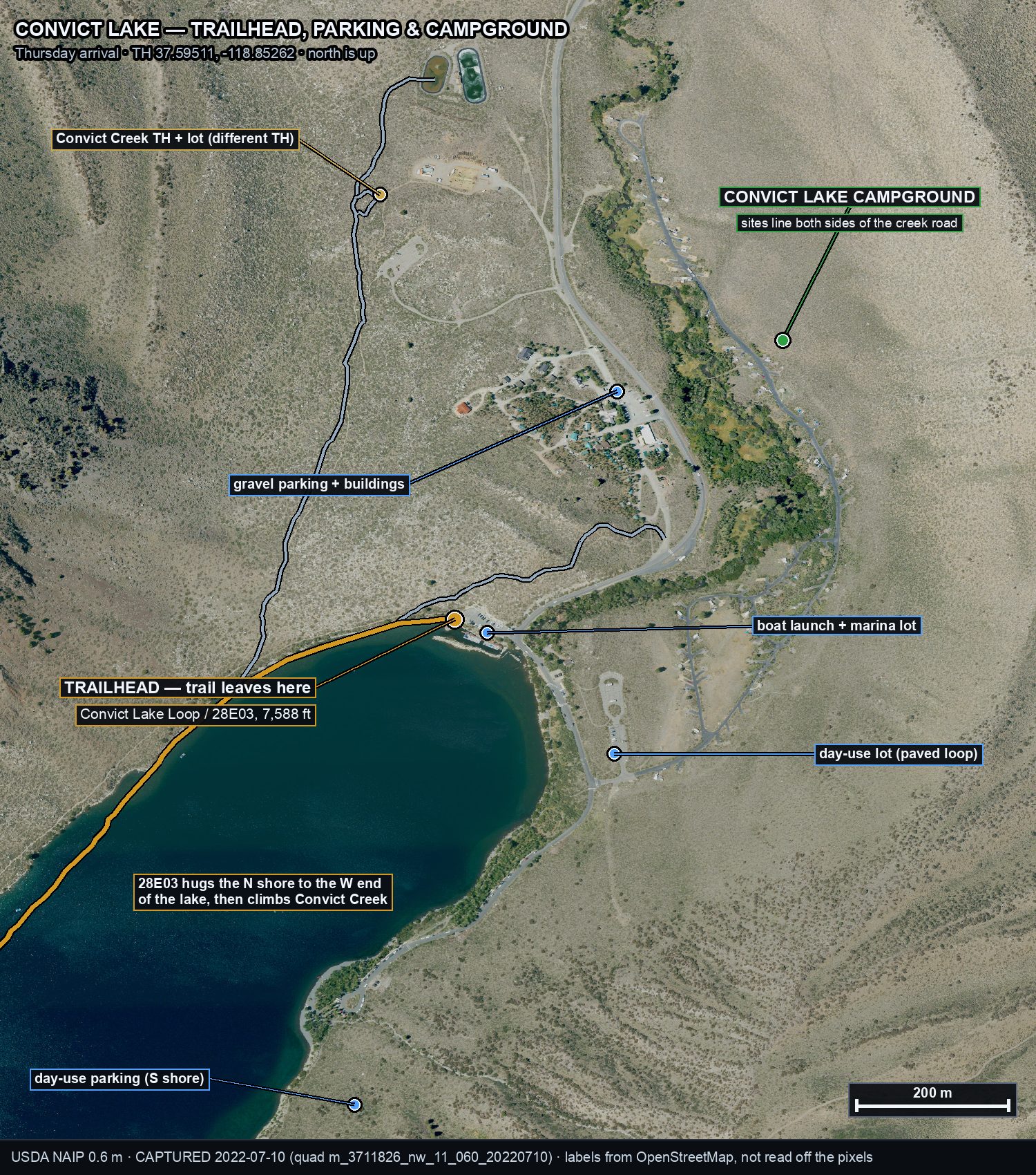 Convict Lake, lots and campground — annotated. Labels drawn over NAIP pixels captured 2022-07-10, 0.6 m. Markers are OpenStreetMap geometry drawn on top, not features traced from the image; do not read continuity of a drawn line as continuity of visible tread.
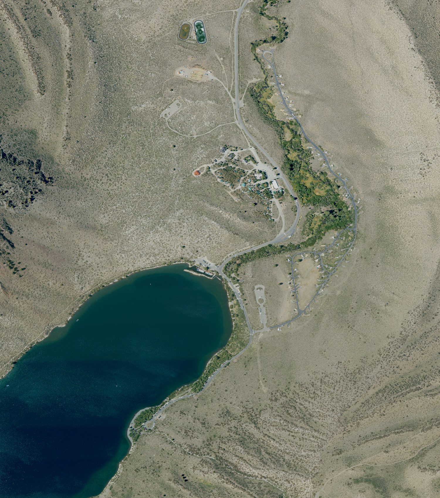 Same extent, unannotated. NAIP, captured 2022-07-10, 0.6 m (catalog item m_3711826_nw_11_060_20220710; the service returned null acquisition fields, so the date is decoded from the quad name per standard NAIP convention, with Year=2022 confirming independently).
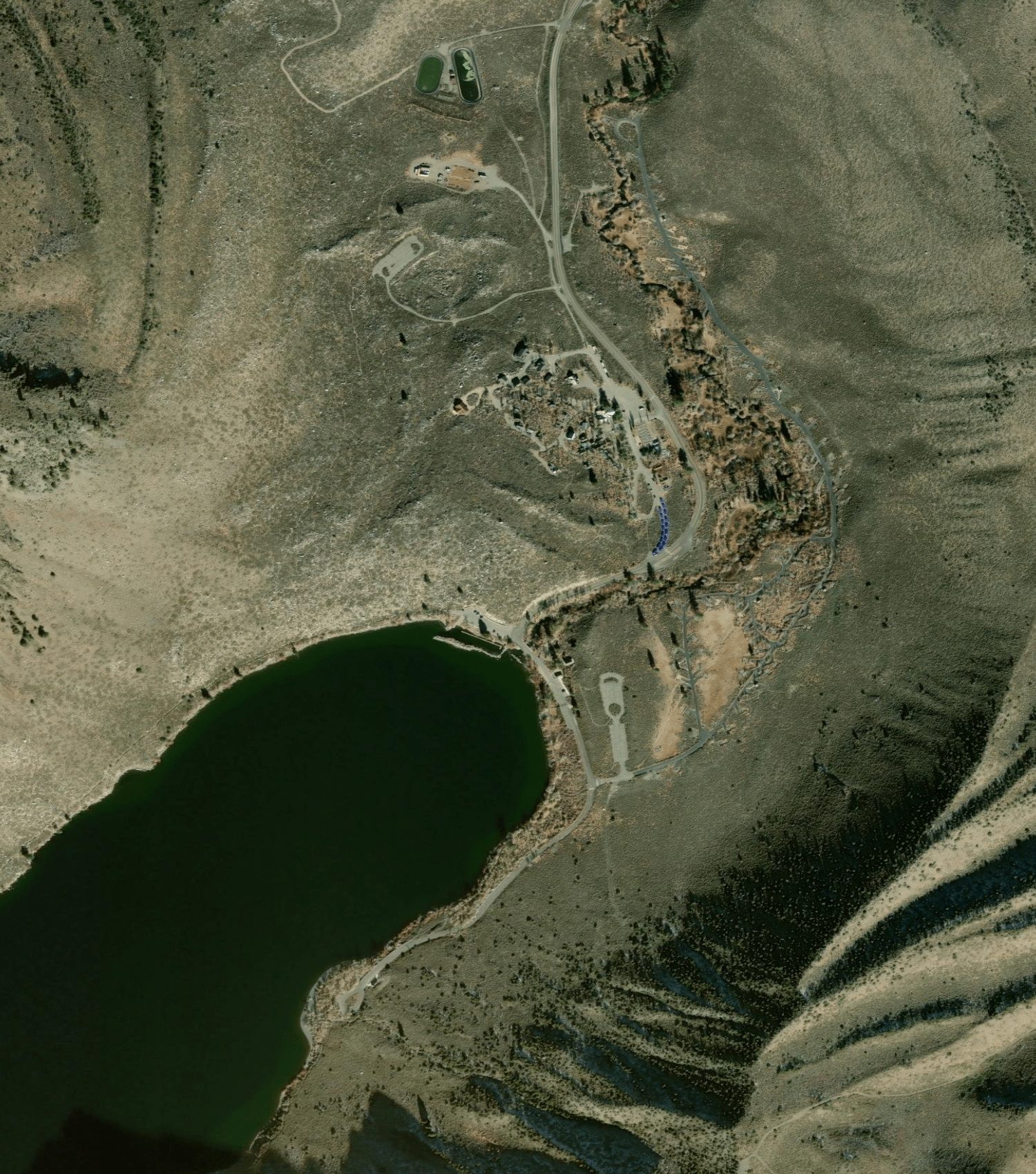 Esri / WorldView-2, captured 2024-11-19, 0.5 m, stated positional accuracy ±8.47 m — so drawn markers can sit up to ~8 m off their true ground position.
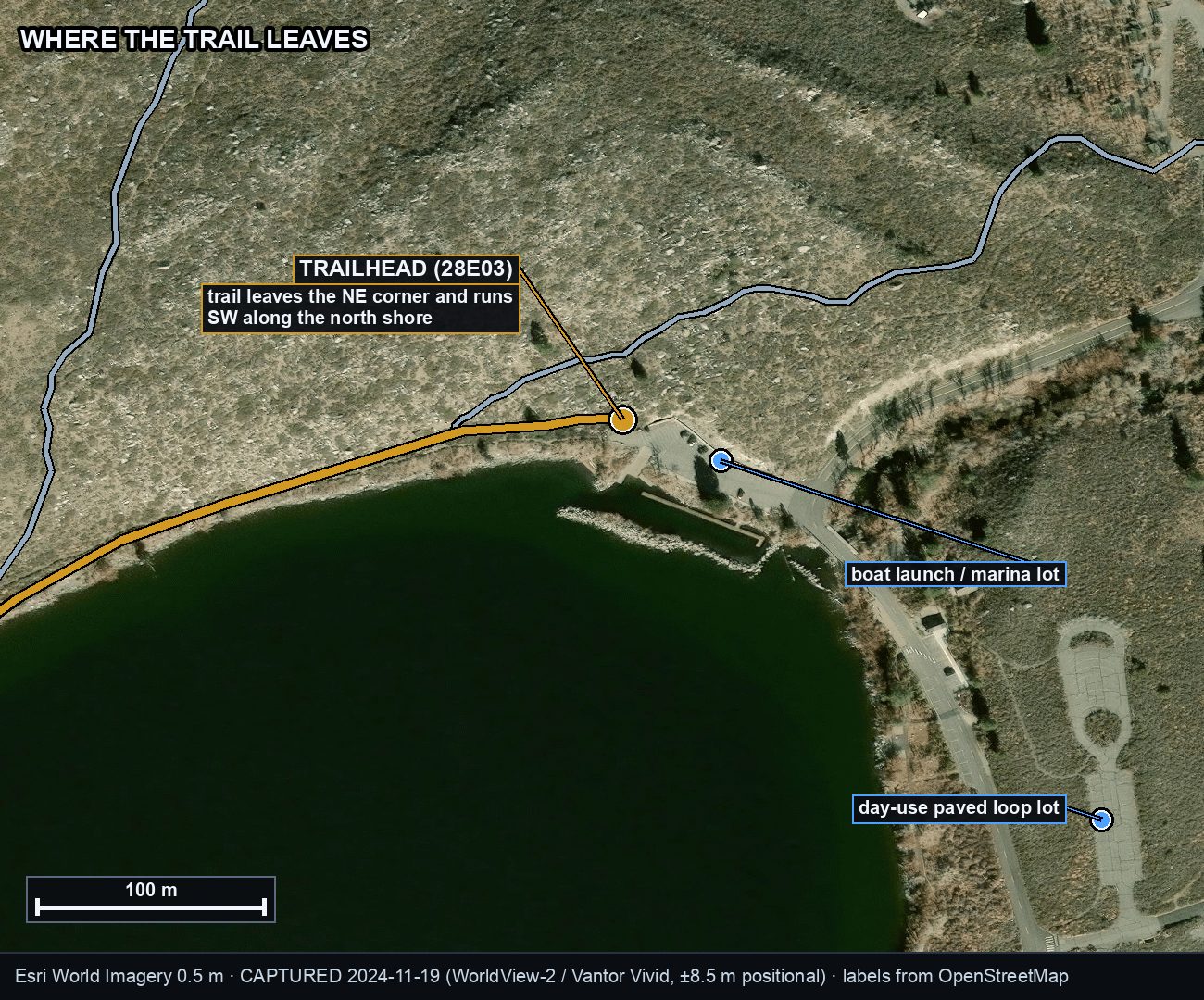 Trailhead close-up — annotated. Labels over Esri / WorldView-2 pixels captured 2024-11-19, 0.5 m.
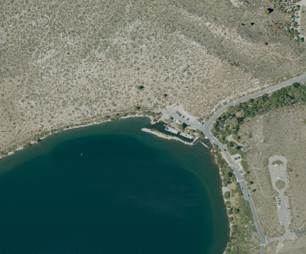 Same close-up. NAIP, captured 2022-07-10, 0.6 m. Trail 28E03 leaving the lake's NE corner is visible across the open granite here.
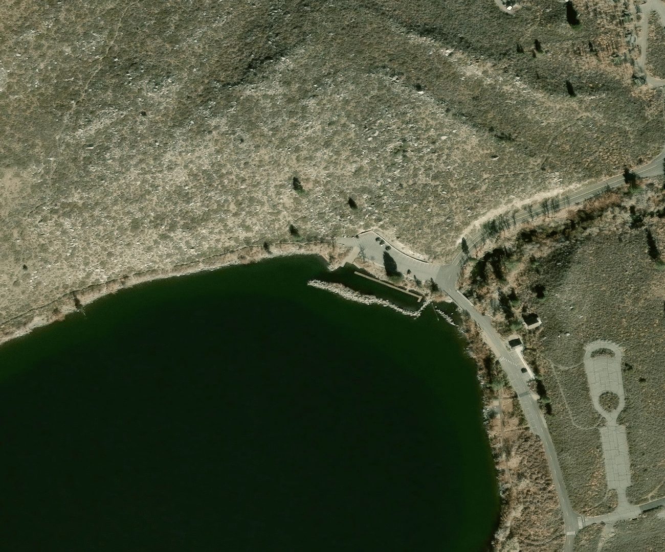 Same close-up. Esri / WorldView-2, captured 2024-11-19, 0.5 m.
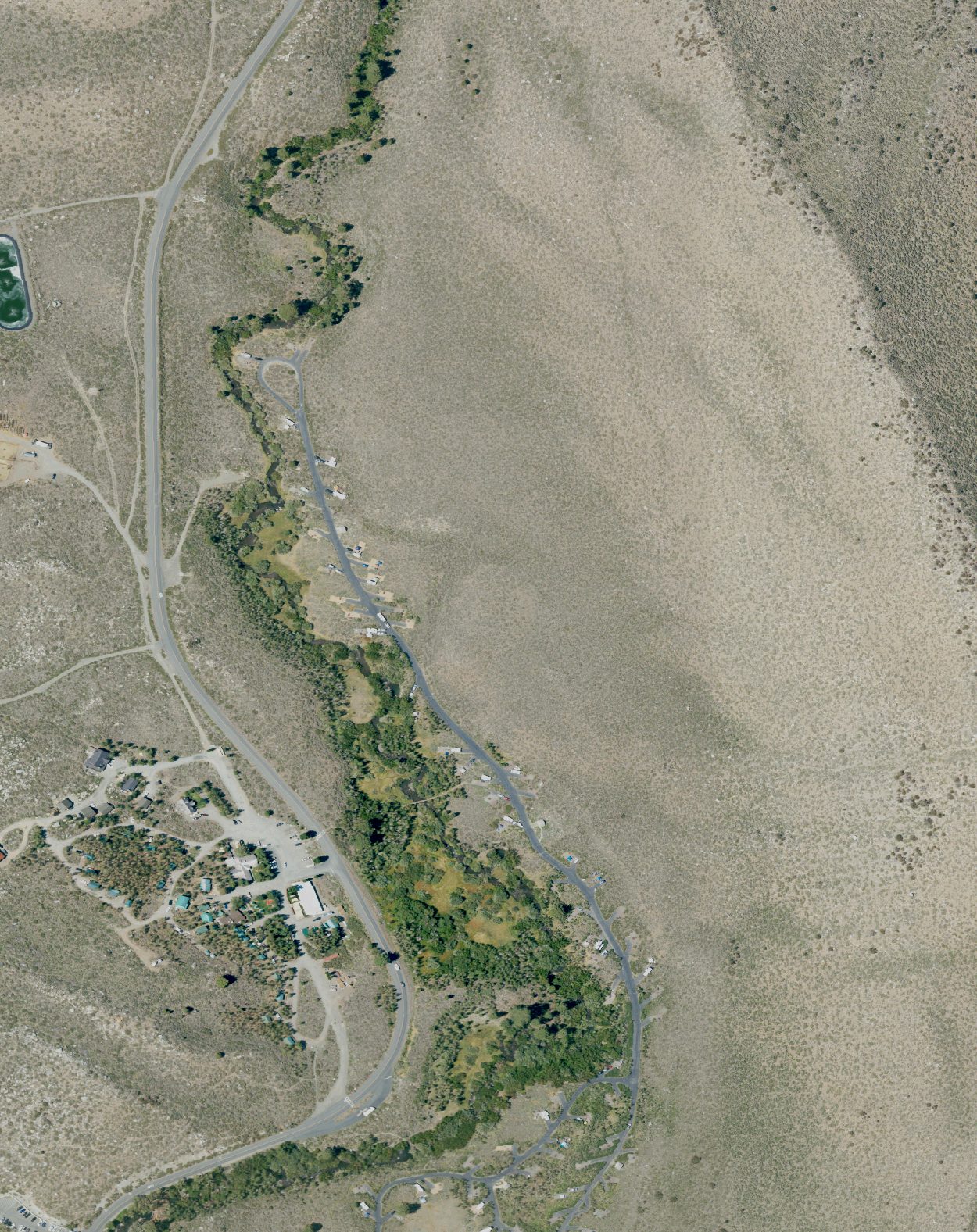 Campground loops and site spurs. NAIP, captured 2022-07-10, 0.6 m. A July capture with sites occupied — RVs and trailers are individually visible, which gives a real length reference against each pad.
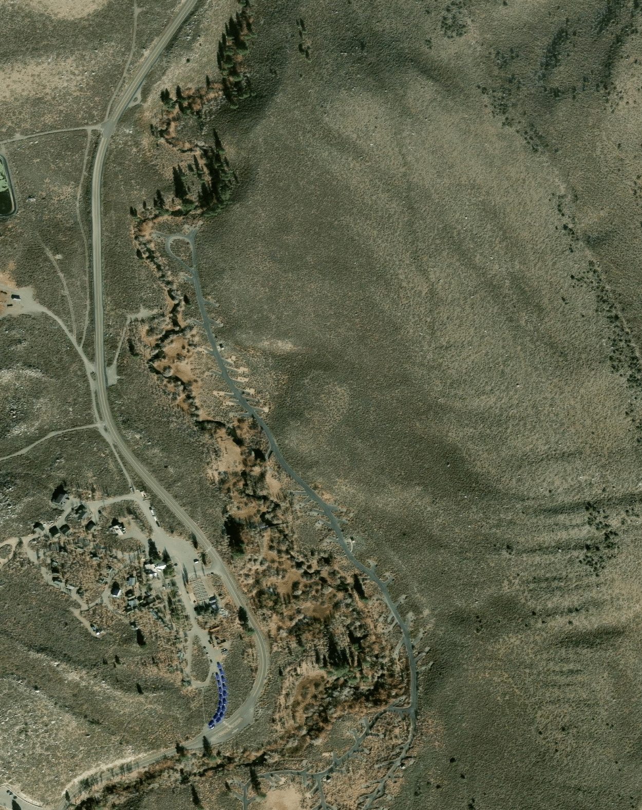 Same loops. Esri / WorldView-2, captured 2024-11-19, 0.5 m. Empty and leaf-off, so the loop road and spur geometry read more cleanly than in the summer frame. The two years are complementary — use both.
Convict Creek scree — Mildred Lake to Lake Dorothy
What the July 2022 frames do show at ~0.84 m/px on the corridor: the broad light-toned unvegetated aprons flanking the drainage below Lake Dorothy read plainly as continuous open rock and talus, consistent with the reported ~6 mi of loose scree — consistent with, not independent confirmation of. Lake outlines, the creek cascade into Mildred Lake, treeline and large blocky boulder fields are all legible. Whether the scree is loose, sized or passable is not: the aprons are visible as landforms, their surface character is not.
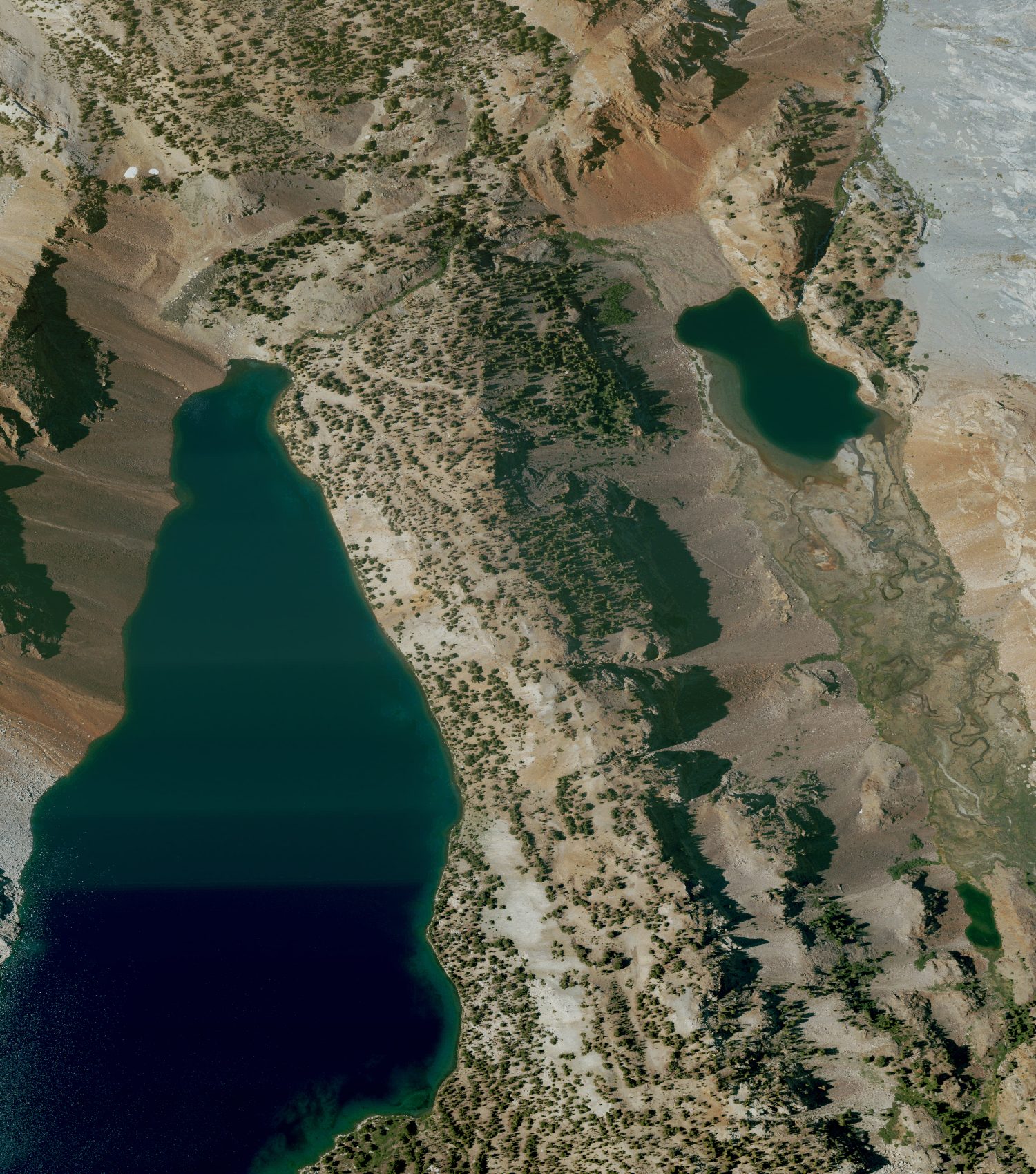 Corridor, ~0.79 × 0.89 mi. NAIP, captured 2022-07-10, 0.6 m native, rendered ~0.84 m/px. Snow-free and well lit.
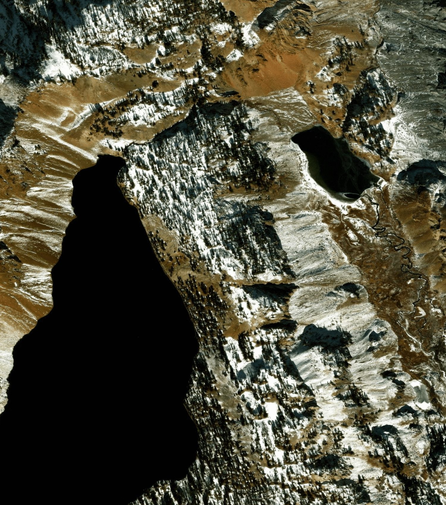 Same corridor. Esri / WorldView-2, captured 2024-11-19, 0.5 m. Included only to document that it is unusable here: mid-November at 9,776–10,275 ft, fresh snow across the drainage, Mildred Lake partly iced, and the entire west wall — including all of Lake Dorothy and much of the trail corridor — in full black terrain shadow with zero recoverable detail. The trail is not visible anywhere in this frame.
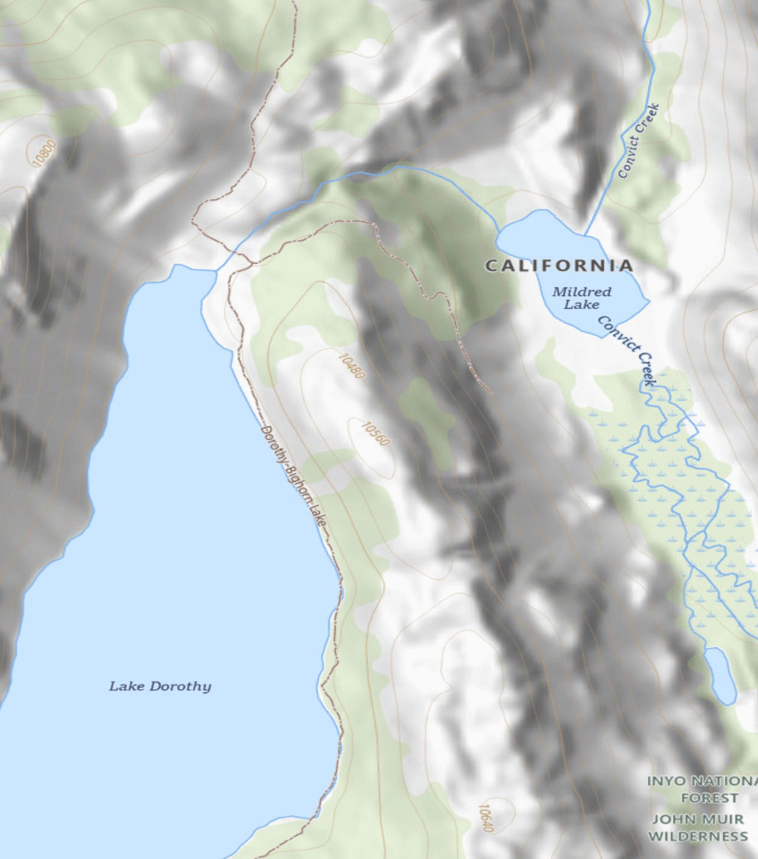 USGS "USGSTopo" of the same corridor. No capture date — a rendered composite of National Map vector layers over 3DEP shaded relief, whose component vintages the endpoint does not expose. Cartography, not a photograph.
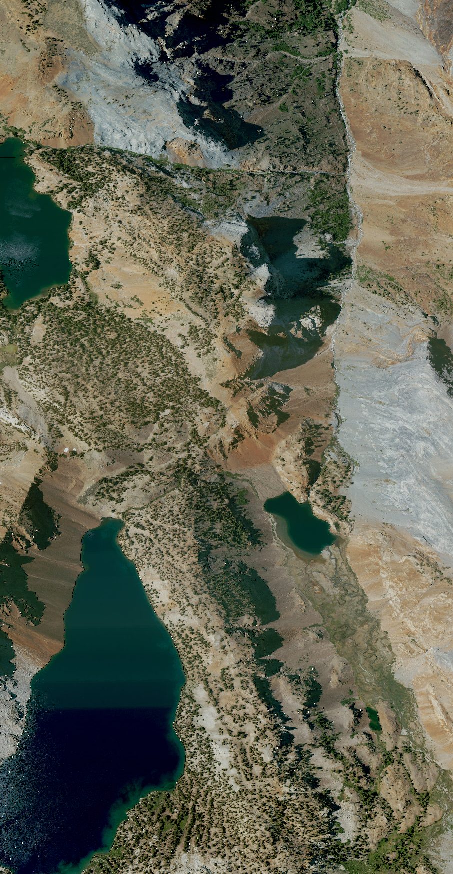 Full drainage strip, ~0.95 × 1.83 mi. NAIP, captured 2022-07-10, 0.6 m native, rendered ~1.69 m/px.
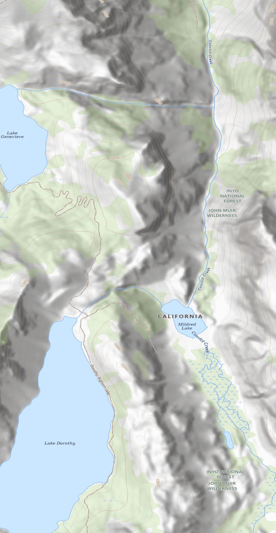 USGSTopo of the same strip. No capture date. Resolves the mapped dashed route labelled "Dorothy–Bighorn Lake" from Mildred Lake up to Lake Dorothy, plus contour spacing showing the gradient — all drawn, none observed.
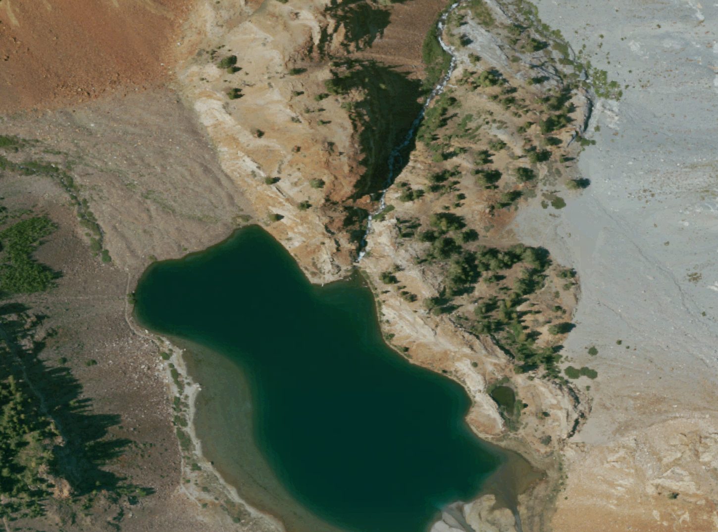 Tightest crop on the mapped bridge node, ~0.30 × 0.22 mi. NAIP, captured 2022-07-10, 0.6 m native rendered at ~0.33 m/px — resampled beyond native, so no extra information exists at this zoom. A 6 m span is about ten pixels at native GSD; at that size a plank bridge is not distinguishable from a light-toned rock band, a patch of bare tread, or a log. There are faint light linear features near the node; they are not callable as a bridge or as its absence, and are not presented as either.
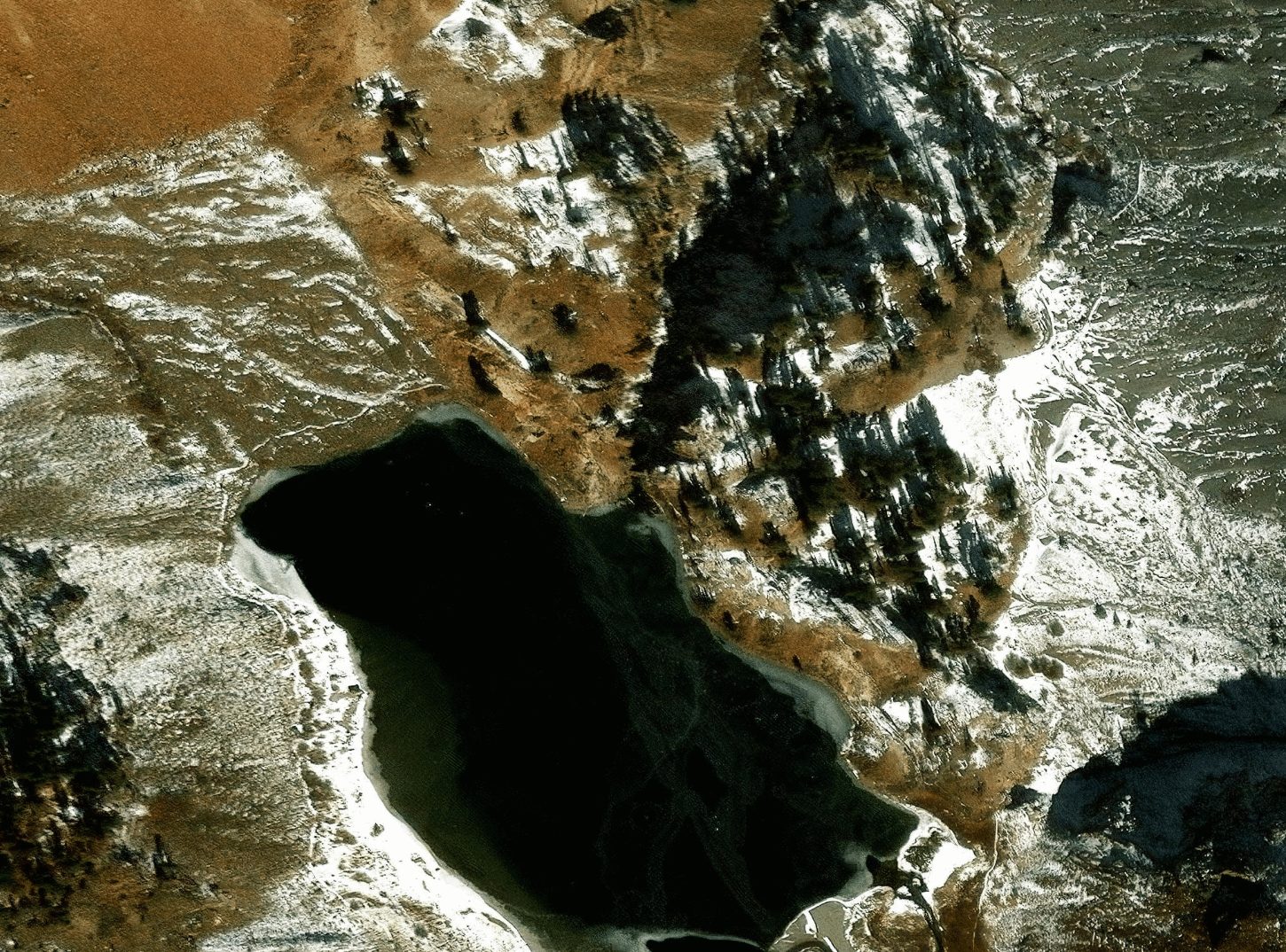 Same crop. Esri / WorldView-2, captured 2024-11-19, 0.5 m native. Snow and shadow; no better answer here than the older frame.
Terrain
Conditions from AllTrails reports dated Jun–Jul 2022. Nothing newer than Jul 2024 exists for this route — treat trail condition as unverified.
Distances from the trailhead
| Point | Miles in | Elevation |
|---|---|---|
| Mildred Lake (passed, not camped) | 4.8 | 9,776 ft |
| Lake Dorothy | 6.4 | 10,275 ft |
| Lake Genevieve | 7.0 | 9,955 ft |
| Laurel Lakes | 11.7 | 9,760 ft |
Route: Convict Lake to Lake Genevieve and Laurel Lakes · 23.4 mi out & back, AllTrails 4.6 (17 reviews). Day distances from OSM trail network; total includes the Lake Dorothy spur. Climb/descent computed along this route from the USGS 3DEP 1/3″ elevation model (~50 m smoothing, 5 m noise filter), rounded to 50 ft.